Bald Mountain:
Mileage: 4.15
Elevation gain: 1545 feet
Trails used: Bald Mountain - Long Pond Trail.
Highlight(s): easy to follow trail to summit with 360 degree views from fire tower.
One of many peaks in the Northeast with the Bald Mountain moniker, this peak caught my eye for the fire tower that resides on its summit area. If not for the fire tower, I would be a t a loss for why this would even warrant the Bald Mountain name. So, with the chance to get almost 360 degree views from here and the day being pretty sunny and clear, I decided to give it a go. I think Brian and I had tried to find this trailhead previously with no luck but I was able to find it today with no problems.
Bald Mountain is located in Westmore, Vermont and is the third highest peak in the Northeast Kingdom. There are three different trails that can be used to reach the summit area, which has a restored fire wardens cabin and fire tower. The fire tower offers fantastic 360 degree views from up high.


I thought about doing the bushwhack over to nearby Goodwin Mountain but since my GPS was on the fritz after Wednesday's hike, I decided to stick to trailed hikes. I knew there was a perfect short hike literally just around the corner from where I was so I did the half mile drive down the road and got to the other trail head.
Highlight(s): easy to follow trail to summit with 360 degree views from fire tower.
One of many peaks in the Northeast with the Bald Mountain moniker, this peak caught my eye for the fire tower that resides on its summit area. If not for the fire tower, I would be a t a loss for why this would even warrant the Bald Mountain name. So, with the chance to get almost 360 degree views from here and the day being pretty sunny and clear, I decided to give it a go. I think Brian and I had tried to find this trailhead previously with no luck but I was able to find it today with no problems.
Bald Mountain is located in Westmore, Vermont and is the third highest peak in the Northeast Kingdom. There are three different trails that can be used to reach the summit area, which has a restored fire wardens cabin and fire tower. The fire tower offers fantastic 360 degree views from up high.
The parking area and signs for the Bald Mountain - Long Pond Trail. There were already four other cars here when I arrived which I did not expect.

As you start the hike, you use part of this old logging road to get to the actual trailed part of the Long Pond Trail.

There are a few signs to point you in the right direction, but the Long Pond Trail starts right near this recent logging area. There is even a register to sign in before you head to the summit.

The lower part of the Long Pond Trail starts off moderately but is very wet and muddy with very little rock steps. You can see where people have gone on either side to get around, further damaging the area.

As the Long Pond Trail starts making its ascent, there are areas like this with some wooden steps to help with the erosion but like the flatter wet sections, people were diverting left and/or right to get around them.


One of the steeper sections of the Long Pond Trail as it makes its way to the summit of Bald Mountain. It was pretty slippery and muddy through here until just below the summit.

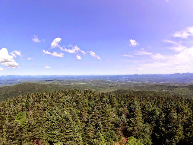
The views from the fire tower on Bald Mountain of nearby Goodwin Mountain, and the Jay Peak area including Gilpin Mountain and Domey's Dome.

Views from the fire tower on the summit of Bald Mountain of the Burke Mountain Ski Area (center) above Bald Hill Pond and Newark Pond. Behind Burke Mountain and barely visible is Franconia Ridge.

More views from the fire tower on Bald Mountain that stretched from Franconia Ridge to the Presidential Range. I could even see the Percy Peaks and more peaks to the north.

Nearby views of Mount Goodwin looking towards the Jay Peak area (right) and Mount Mansfield are (middle) from the fire tower on Bald Mountain. The views stretched towards Camel Hump and the Ellen-Abraham Range.

Looking northwest into Canada from the fire tower on the summit of Bald Mountain.

Like I said, 360 degree views from here. Unfortunately I had my GoPro at the time so I couldn't really zoom in.

The old fire tower and restored cabin on the summit of Bald Mountain (elevation: 3300 feet).

A muddy section of the Long Pond Trail as I was hiking back to the car.

I thought about doing the bushwhack over to nearby Goodwin Mountain but since my GPS was on the fritz after Wednesday's hike, I decided to stick to trailed hikes. I knew there was a perfect short hike literally just around the corner from where I was so I did the half mile drive down the road and got to the other trail head.
Haystack Mountain
Mileage: 1.85
Elevation gain: 910 feet
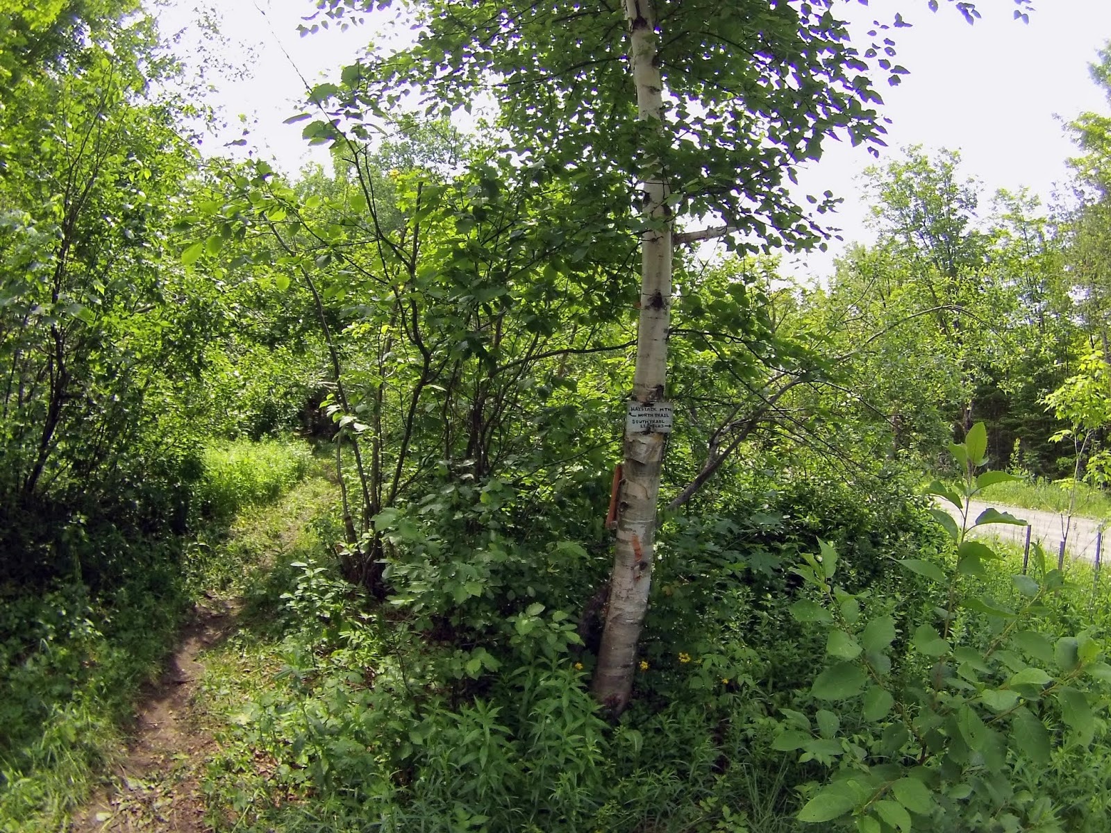
Trails used: Haystack Mountain North Trail.
Highlight(s): short but steep trail, decent views from three different view points near the summit.
Highlight(s): short but steep trail, decent views from three different view points near the summit.
Good thing I saw there was a trail on this hike or I wouldn't have known about it being right around the corner from Bald Mountain. So with less than a half mile drive around the corner to the trailhead, I decided to give it a go since it was still early and my last climb didn't tax me too much.
Haystack Mountain is located in Westmore, Vermont. There are two trails that reach the summit: the aptly named North Trail and South Trail. There are three different viewpoints from just below the summit of Haystack Mountain, and also a few along the trail so if you want views, you shouldn't be dissapointed. The actual summit of Haystack Mountain is wooded and view-less.
There is room for about three tightly packed cars at the Haystack Mountain North Trail trailhead parking area off of Long Pond Road.
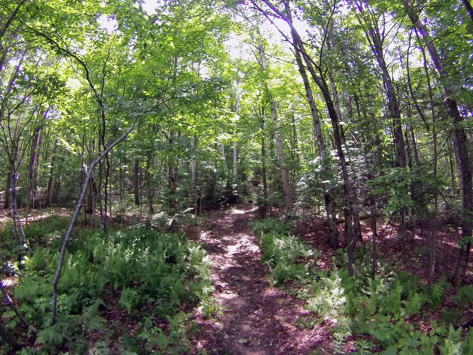
Like Bald Mountain, the Haystack Mountain North Trail starts off pretty mellow but then kicks it into high gear.
One of the few muddy sections along the Haystack Mountain North Trail. Right after this area is a small water crossing and then it gets steep until the summit.

A section of the Haystack Mountain North Trail as it ascends very steeply to the Haystack Mountain summit. I think it was roughly about 300+ feet in about .20 miles.

The summit cairn on the high point of Haystack Mountain (elevation: 2712 feet). There are several viewpoints that branch off from here but no views from the actual summit. There is also a register to sign into below the summit.

I went over the summit of Haystack Mountain on the Haystack Mountain South Trail to the east lookout which had this small view towards Bald Mountain. I didn't want to do any more down to reach the south view point.

The western view point just below the summit of Haystack Mountain looking towards nearby Long Pond with Hedgehog Mountain just behind it. To the left is Mount Pisgah.

The steepness of the Haystack Mountain North Trail as it descends from the summit of Haystack Mountain.

The Haystack Mountain North Trail was blazed in yellow and easy to follow.

Two really nice hikes and pretty popular. Bald Mountain had a steady flow of hikers heading up to the summit as I was going back down to the car. On Haystack Mountain, I passed two groups of hikers and then I was alone after that. The views were nice, the trails were not too bad but with the recent rainy weather there were muddy areas, and there were no bugs as there was a nice breeze going. I highly recommend either of these hikes. Bonus: Lake Willoughby is nearby so camping/hiking/boating/swimming potentials is limitless.
No comments:
Post a Comment