Elevation gain: 3090 feet
Trails used: Monroe Trail, Dean Trail, Long Trail, bushwhack, Allis Trail.
Highlight(s): Long Trail, open woods bushwhack, register on the summit of Ethan Allen East Peak.
I got the call Monday afternoon and had another day off due to issues at work. The previous two days were rainy and on the cooler side so today was going to be a better day to hike. I figured I would need to do something with some sort of views and had a few peaks in mind, but decided on Ethan Allen Mountain. We had used the Monroe Trail, and Dean Trail to make it to Wind Gap, then took the Long Trail North to get to the summit of Camels Hump. We didn't take the one mile detour to the summit of Ethan Allen Mountain at that time though since we figured it would make the day longer. With a nice breeze and despite the temperatures heading into the 80's, it was a perfect day for a hike.
Ethan Allen Mountain and Ethan Allen East Peak are located in Duxbury, Vermont and also in Camels Hump State Forest. There are several trails that you can take to reach the summit of Ethan Allen Mountain, which has views from several areas on the summit and also from the Long Trail. The summit of Ethan Allen East Peak is wooded and view-less. There are also no trails that go to Ethan Allen East Peak so a lengthy bushwhack is required.
Ethan Allen Mountain and Ethan Allen East Peak are on the Vermont 100 Highest List, the Vermont 200 Highest List and the Vermont 3k List.
Camels Hump State Park
Camels Hump State Park Trails
I parked at the winter lot for the Camels Hump State Park, as I didn't trust my car driving up to the main lot. I would take the Monroe Trail to head up towards the Long Trail. Desi and I took this trail several years ago when we hiked Camels Hump.

The blue blazed Monroe Trail is pretty east to follow and mellow until it reaches the junction with the Dean Trail.

The junction of the Monroe Trail/Dean Trail. The Dean Trail, from here to Wind Gap is also pretty mellow as far as elevation goes. Two nice trails to link up to get to the Long Trail.

There are various stream crossings but the three major ones all have bridges to cross. The water wasn't flowing that much, despite the rain for the past two days prior.

Right before you reach Wind Gap, this beaver pond offers a nice view of Camels Hump.
A nice blurry picture of the Long Trail, Allis Trail, and Dean Trail junction. I would take the Long Trail south to Ethan Allen Mountain.

The Long Trail passes by the Montclair Glen Lodge, which has ten bunks. A caretaker is here in season and a fee is charged to stay here.

After the Montclair Glen Lodge, the Long Trail started off mellow but then got steep as I began the climb towards the summit of Ethan Allen Mountain. I passed three Long Trail thru hikers at this point.

The hardest section of the Long Trail between Wind Gap and the summit of Ethan Allen Mountain was this wet, steep ledge area.

The views from the northern summit of Ethan Allen Mountain looking towards southeastern Vermont, and Ethan Allen East Peak which would be my next objective.

The views from the northern summit of Ethan Allen Mountain looking northwest towards the Worcester Mountain Range and Putnam State Forest area.

The north summit of Ethan Allen Mountain (elevation: 3680 feet), which is the slightly lower summit of the two summits of Ethan Allen Mountain.

A short hike south is the southern summit of Ethan Allen Mountain (elevation: 3688 feet), which is the highest point for this peak.

I started my bushwhack towards Ethan Allen East Peak by heading southeast down a steep section from the summit of Ethan Allen Mountain, then made it into nice open woods.

The woods remained open throughout the bushwhack over to Ethan Allen East Peak, as I followed various herd paths through fern and hobblebush.

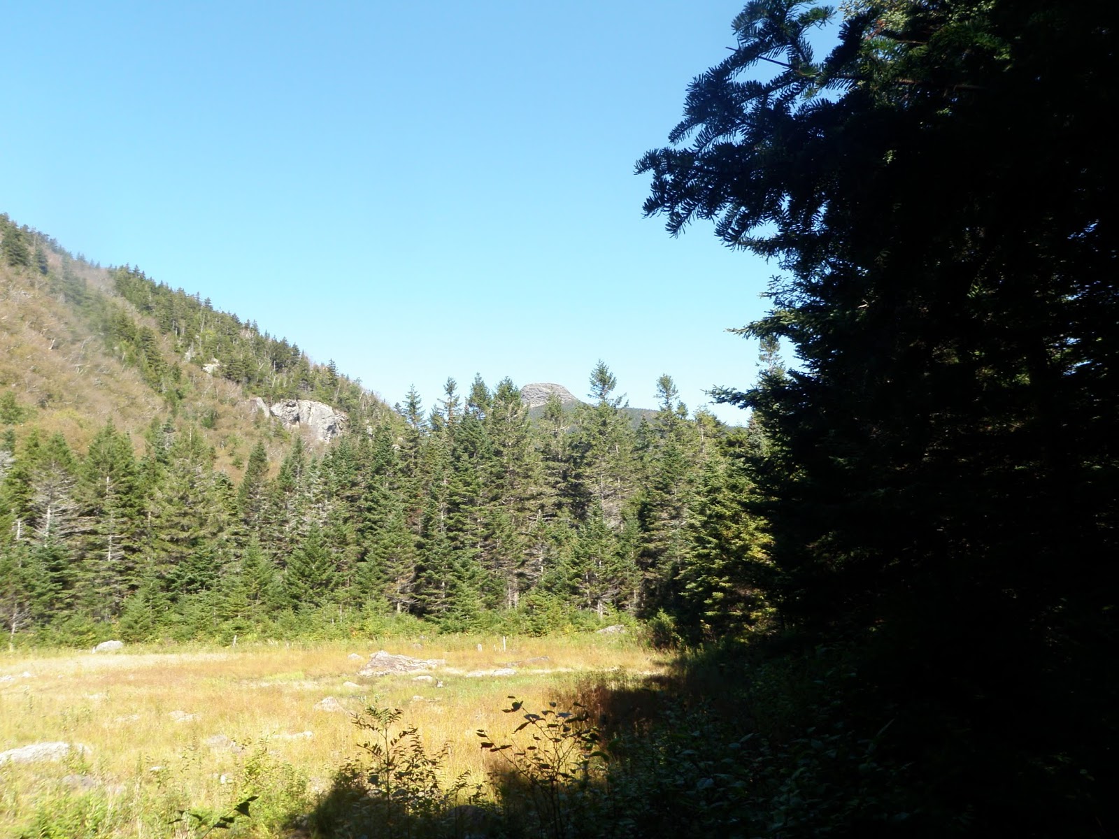
A quick glimpse of Ethan Allen East Peak, as I am about 0.30 miles away from the summit. It sometimes looks like it is further away than it really is.

The registers on the summit of Ethan Allen East Peak (elevation: 3160 feet). There are no views from this wooded summit.

Once I was done signing in, I decided to make a line for the Dean Trail which was still almost two miles away from Ethan Allen East Peak.

I found myself taking too much time bushwhacking so I decided to do some elevation gain and hit the Allis Trail. I managed to come out of the woods right where it junctions to the south with the Long Trail. There were views looking south towards Ethan Allen Mountain from the Allis Trail, and there was a bench here to rest and take in the views.

A view of Camels Hump from the Allis Trail viewpoint.

Once I made it back to the Dean Trail, I kicked up the pace and headed back to the car in roughly an hour. After that it was time for the nice drive home.
It was nice to hit Ethan Allen Mountain, and although Ethan Allen East Peak was in open woods for the whole hike, I really dislike bushwhacks of more than two miles. The pleasant weather and decent views made up for that though. A perfect day off from work for a hike.
No comments:
Post a Comment